Chesapeake Beach Weeks
Quests for Sandy Toes that Were So Much More
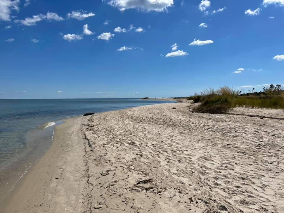
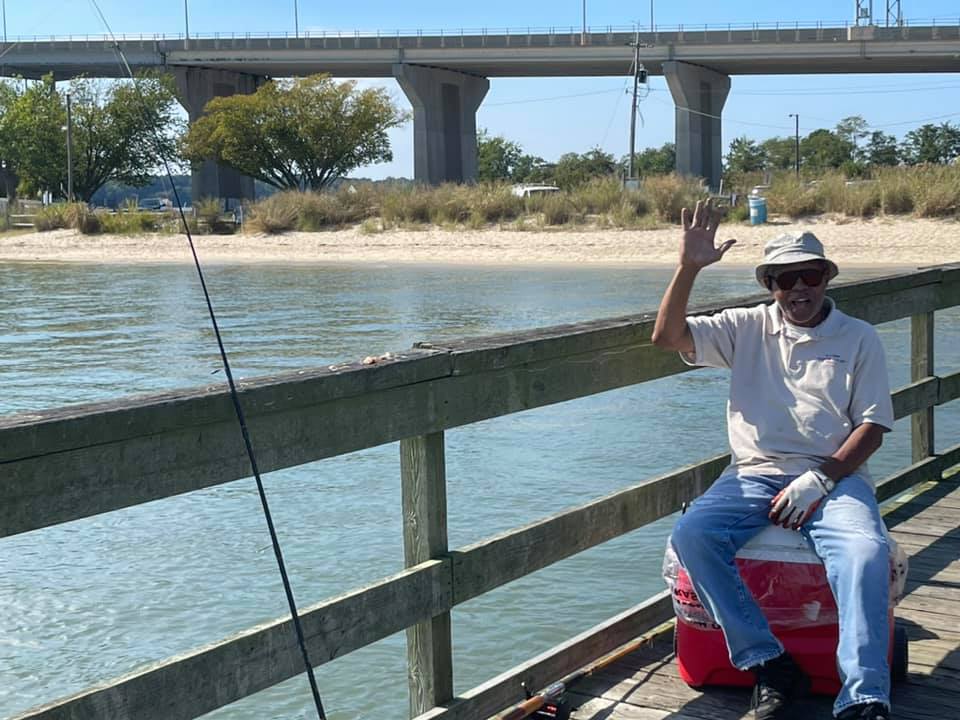 At Beach Week 2021, Beach #20, Gloucester Point Beach Park on the York River, Gloucester Point, Virginia, I met Louis, another avid fisherman. It was his first time at the park. This landscape, once known as Tsenacomoco, was home to some of the tribes in the Algonquian-speaking alliance that paid tribute to Wahunsenacawh, whom the English called Chief Powhatan. Credit: JCouser At Beach Week 2021, Beach #20, Gloucester Point Beach Park on the York River, Gloucester Point, Virginia, I met Louis, another avid fisherman. It was his first time at the park. This landscape, once known as Tsenacomoco, was home to some of the tribes in the Algonquian-speaking alliance that paid tribute to Wahunsenacawh, whom the English called Chief Powhatan. Credit: JCouser It was the fourth week of September 2020, and the weather was gorgeous. I had vacation time to use, but my husband and two daughters were still tethered to their Zooms. So, I set out by myself to see how many sandy beaches I could visit within a reasonable drive from our Annapolis, Maryland, home. Over five days, I made it to 32 beaches and enjoyed one of the most epic adventures of my life, sharing the journey along the way with my friends on social media. A year later, in September 2021, I challenged myself to do it again, making it to 37 different beaches in five days. In September 2022, another 31 beaches, and in September/October 2023 for a grant total of 123 so far! Ground Rules First, I had some ground rules. To qualify for this quest, the beach must be on the Chesapeake Bay or one of the tributaries and must be publicly accessible. This doesn’t necessarily mean public land, however. One beach was privately owned, but anyone can visit for the day or even camp there for a fee. For the most part, however, I visited federal, state, county and municipal lands. Some of the parks I visited have free admission, but many charge a fee ranging from $2.50 to $15.00 per person or vehicle. Disclaimer For one day I cheated on our beloved Chesapeake and traveled to Delaware Bay, which I also love, but I wore plenty of Chesapeake swag to make my true allegiances known. Planning To plan my trips, I used FindYourChesapeake.com, a partnership website from the National Park Service Chesapeake Bay Office and Chesapeake Conservancy [NOTE: In 2023, the NPS funding for this website was discontinued, and the website is no longer available]. In addition, I also used Google and even aerial imagery to detect sandy stretches of shoreline. Then I researched if they were publicly accessible. There Was a Lot More to This Journey than Just Sand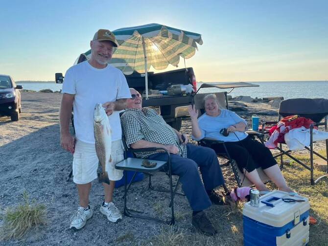 At Beach Week 2021, Beach #6, Guard Shore Beach, near Bloxom, Virginia, and the Saxis Wildlife Management Area, I met these self-proclaimed “Shore Folks” who had moved to West Virginia and were back visiting their beloved Shore in Accomack County. I asked them which they liked better, and they said, “Shore! Without a doubt!” In this area, English explorer Captain John Smith met the Pocomoke Indians in 1608. Credit: JCouser At Beach Week 2021, Beach #6, Guard Shore Beach, near Bloxom, Virginia, and the Saxis Wildlife Management Area, I met these self-proclaimed “Shore Folks” who had moved to West Virginia and were back visiting their beloved Shore in Accomack County. I asked them which they liked better, and they said, “Shore! Without a doubt!” In this area, English explorer Captain John Smith met the Pocomoke Indians in 1608. Credit: JCouser History A journey to the beaches of the Chesapeake is also a journey through its history. Some of that history is quite painful, and the effects are still felt by many even to this day. Thoughts of the Indigenous people who lived here for more than 10,000 years before the European colonists (reflected in so many of the parks’ names: Kiptopeke, Chippokes, Matapeake, and Aquia—named for Algonquian Indian word for gulls)—and thoughts of the enslaved people whose labor enabled the many plantations that lined the Chesapeake’s shores made standing on a beach not just standing on a beach. I could literally feel the history of the place, and it was heavy. I was really struck by how many of the parks were former plantations. As conservationists, you understand how these large tracts of intact land made them ideal for conservation. Sometimes the family bequeathed the land to the state, or sometimes funds were raised to purchase the land. These are places with stories to tell—and certainly not just the stories of the plantation owners. Throughout my trips, I typically took a silly selfie photo on the beach, a way to mark that I had reached another milestone on the quest. But looking back at my pictures, I am reminded that at quite a few places, I just couldn’t. Did I really want to stand there on a beach smiling where hundreds of people were enslaved? No. Not every beach got the selfie. At some places—like Fort Monroe, where 402 years ago, the White Lion carried 20-30 enslaved people from Angola, considered to be the beginning of race-based slavery in America—the history was too heavy, and the moments were just too solemn. But isn’t that the point? What I am describing is a vital part of many park experiences. These are places where we can learn about and reflect upon the people who came before us. While not an expert on the Chesapeake’s history, I do have an insatiable curiosity. I want to learn more, and I want to ensure that my daughters learn more. Helping us better understand how we got to where we are now is a huge part of why these places are so very important to conserve and share with the public. Sense of Place I do a lot of reading and writing about the Chesapeake both professionally and personally, even as part of my own genealogical research. Thanks to these beach trips, I have a much deeper sense of place. Here is just one example: One day, I was following my car’s GPS directions basically on autopilot when I happened to notice on a few street signs that I was traveling through San Domingo, an area established in the 1800s by free Black men and women in Maryland’s Wicomico County. Of course, I paused on beaches and spent a little more time exploring San Domingo, which I had read about in the Chesapeake Bay Journal and The Baltimore Sun. Thanks to that fortuitous stop, I now will have a sense of place as I learn more about this area in the months to come. People The most memorable parts of both the 2020 and 2021 trips were the people I met. Something about a beach breaks down social barriers. You may remember making beach friends when you were little: you start building a sandcastle with another child, who you would probably be too shy to speak to were it not for the magic of the beach. I feel like I’ve been on a grown-up version of that. I work in public relations, and I’ll have a conversation with anyone who is willing, but there is just something different when it comes to the beach. What’s Your Favorite Beach? I heard from many people during my trips: my own Facebook friends, of course, but also people who heard about the trip —from a county leader in tourism thanking me for stopping by, professional colleagues and even a Maryland cabinet secretary who took the time to write. They often asked: “What’s your favorite beach? Which one would you recommend?” Each beach has a different personality, but I love them all. My honest answer is the best beach is the one that you can get yourself to. Closing Thoughts… So, I made it to 123 beaches in 20 days of exploring. Although drop-by visits to the Chesapeake’s diverse beaches are not ideal, I consider these whirlwind trips to be reconnaissance for choosing places to return to with family and friends and the time to truly enjoy what each place has to offer. This probably sounds like folks who live or visit around here have plenty of beach access. You may have noticed that my photos show few people. Consider, though, that I had the luxury of taking vacation time and doing my exploring during the week in the off-season, something not everyone can do. It’s a different story in peak season, especially weekends, when many of the places I traveled to are filled to capacity, and park employees must turn people away at the gate. Or, if there is no gate, there’s simply no parking left for all the people who want to visit. This was true even before the pandemic, but now, even more people are turning to nature for solace and recreation. Our demand for water access and outdoor recreation is pushing our parks to the limits. One natural area preserve that I visited in 2021 had no trash cans and no bathrooms, and there were just a handful of unofficial parking spots. Many of you know this is customary for nature preserves meant for low human impact. This worked fine for my off-season, weekday, brief visit, when I was the only one on the beach for most of my time there. But a local woman told me that on summer weekends, there are hundreds of visitors a day, many of whom stay for a significant amount of time. Hundreds. Remember, there are no bathrooms and no trash cans and very little parking. Remember, too, that every single one of those hundreds of visitors a day has the right to be there. Just down the street from the last beach I visited in 2021 (North Beach in North Beach, Maryland), is the resort town called Chesapeake Beach. To visit their public beach, called “Bayfront” or “Brownie’s Beach” by locals, you must literally be a local. During 2020, it was only open to municipal residents as a Covid-related precaution. It remains closed to non-residents due to the potential for collapse along the cliffs area. This is a reminder to check for the latest information on beach closures before you go. Communities are grappling with how to provide public access, including near my home, where Sandy Point State Park fills to capacity and turns people away on the most glorious summer weekends. I certainly don’t have the answers, but I do know that we need more parks. Parks don’t make themselves. Here’s a shout-out to everyone working in conservation and trying to create more opportunities for people to visit beautiful places like these. Now more than ever, it is important that our federal, state and local governments, along with nonprofits, foundations and private donors, work to conserve more sites for public access to the Bay. What started out as a Covid-safe solo “staycation” adventure turned out to be so much more. We’re lucky to live where we are surrounded by beauty in nature, amazing wildlife and the opportunity to learn the history of the Chesapeake and its people past and present. Here I will share a list of all 123 beaches, photos and invite you to follow along the three journeys! P.S. There are so many more to see! Same time next year!  Small world! At Beach Week 2020, Beach #31, Harry and Jeanette Weinberg Park in Pasadena, Maryland, there was only one other person at the park—my big brother! Neither of us had been to this park before, and it’s not near our homes. A phenomenal coincidence! Credit: JCouser
0 Comments
Beach #120 Theodore Roosevelt Island Park, Washington, DC 20001 Hello from Beach #120 located on Theodore Roosevelt Island outside Washington, D.C. and maintained by the National Park Service. This little murky "beach" is very dependent on it being low tide during your visit. You could bring your beach chair so I am counting this urban oasis.
Roosevelt Island has had quite a history! For a while, it was a temporary home to the Nacotchtank Indians who had been living nearby, where the Potomac and Anacostia Rivers meet. The land was once inherited by our founding father, George Mason, while he was still underage. He would grow up to become one of the three delegates to the 1787 Constitutional Convention who would refuse to sign the Constitution. His work would later heavily influence our Bill of Rights. The island served as Camp Green during the Civil War when it was home to 1,200 formerly enslaved people who were part of the Union forces. During the Spanish-American War, the island was used to test explosives for commercial mining, and those tests were mistaken for enemy wartime activity. Then, the island belonged to the power company for a while until it became a memorial to our 26th president and a park planned by the famous Frederick Law Olmsted Jr. To get here, I parked in the Roosevelt Island parking lot, took a footbridge to the island and then followed the 1.5-mile loop, Swamp Trail. Our 26th president left quite a conservation legacy, but it's complicated to herald him with our worldview in 2023. Like many others at the time, the father of our national parks system viewed people of European descent to be superior and the park system displaced Indigenous people. Beach #121 National Harbor, 141 American Way, Oxon Hill, MD 20745 Hello from Beach #121, a manmade sandy beach at National Harbor, a huge mixed-use development in Oxon Hill, Md. complete with 6 hotels, a convention center, a Ferris wheel and casino. Hard fought at the time of development by conservationists, there are about 5,500 residents here and 28 million visitors per year.
In the 1800s, this land was the Salubria plantation, owned by a slaveholder who served as a surgeon in the Union Army and a Maryland State Delegate, he ultimately called for Maryland to abolish slavery. There's a striking sculpture here called "The Awakening" by artist J. Seward Johnson. This spot offers a beautiful view of the Potomac River in Prince George's County. Beach #119 Dyke Marsh Wildlife Preserve, (Belle Haven Park, Virginia) 6401 George Washington Memorial Pkwy Alexandria, VA 22307 Good morning from Beach #119 along the Potomac River in Fairfax County, Virginia. I'm on the Mount Vernon Trail along the George Washington Memorial Parkway leading to the Dyke Marsh Wildlife Preserve, a unit of the National Park Service. Looking across the Potomac, I can see The Capital Wheel at National Harbor.
Dyke Marsh Wildlife Preserve got its name because, in the 1800s, marshland was filled in to create a dike to add additional farmland. Today, this is "one of the largest remaining pieces of freshwater tidal wetlands left in the Baltimore-Washington Metropolitan Area." Friends of Dyke Marsh host bird walks every Sunday at 8 a.m. (meet in the Belle Haven Park south parking lot). Over 250 species of birds have been seen at this park. To get here, I took about a 10-minute walk from the Mount Vernon Trail Parking lot at the Belle Haven Marina exit from the parkway. Beach #123 Piscataway Park, 3400 Bryan Point Road, Accokeek, MD 20607 Good night from Beach #123, the last beach on the agenda for 2023, found at National Park Service's Piscataway Park / National Colonial Farm in Accoceek, Md.
Piscataway Park is part of the ancestral homeland of the Piscataway people. In 2012, the Piscataway Indian Nation and Tayac Territory, Piscataway-Conoy Tribe of Maryland, and Cedarville Band of Piscataway finally received official recognition as tribes from the state of Maryland. In 1928, Henry and Alice Ferguson bought more than 100 acres in this area and encouraged their friends to become their neighbors, all with an eye toward protecting the environment. Following his wife's death, Mr. Ferguson established the Alice Ferguson Foundation, which ultimately donated the land to the National Park Service and, in doing so, protected the viewshed of Mount Vernon just across the Potomac River so that visitors to George Washington's residence can imagine what the people of that era may have seen. Piscataway Park and adjacent Colonial Farm Park are home to many of the Chesapeake's most iconic species. Today, I hiked the Mockley Point Trail and found this beautiful spot. That's a wrap for Beach Week 2023! Please check out my website, and I hope to see you soon -- at the beach! Beach #122 Fort Foote Park, 8915 Fort Foote Road, Fort Washington, MD 20744 Beach #122 is National Park Service's Fort Foote on the Potomac River in Prince George's County. Fort Foote was an important defensive outpost for the ports of Georgetown, Alexandria and Washington during the Civil War, and later put to use again during World War I and World War II.
Named after Rear Adm. Andrew H. Foote, just 8 miles south of our nation's capital, today Fort Foote Park is treasured for hiking and fishing. Beach #115 Kings Landing Park, 3255 Kings Landing Road, Huntingtown, MD 20639 Good morning from Beach #115. I'm back out beaching to make up the two days I lost to Tropical Storm Ophelia and a back-to-work delay. Today starts with Kings Landing Park in Calvert County on the shores of the Patuxent River.
There's just a small beach here most often used for paddle access, but it's big enough for a beach chair so it counts! There's a great fishing pier here. Kings Landing was once a farm and later Baltimore's YMCA Camp Mohawk for city youth in the 1950s. Today is Indigenous Peoples' Day. The Patuxent, or Pawtuxent, people lived along the Chesapeake's western shore. Captain John Smith noted their 17 villages along this river. It is believed that the word Patuxent meant either "water running over loose stones" or "place where tobacco grows." Beach #116 Endeavor Point, 7890 Mill Creek Road, Benedict, MD 20612 Hello from Charles County and Beach #116, Endeavor Point, in Benedict, Md. I've been here since 11:30 am, and I've made a new friend! Meet Sophia who purchased this campground during the pandemic with her partner in a total career and life changing moment.
They have created a welcoming place for all to enjoy on the grounds of what was once Camp Stanton. According to the state of Maryland, Camp Stanton was a "former Union encampment established in 1863 for the recruitment and training of black soldiers, some whom had recently escaped enslavement." Endeavor Point is now a private resort/camp ground on the Patuxent River that offers day passes (I paid just $10 to enter today, not much more than some of Maryland's public parks). You can rent a waterfront cottage, camp under the stars, or purchase a day pass and fish from their pier or shoreline, go birding, relax on the beach or rent kayaks or standup paddle boards. This is a great place to host a corporate event or a wedding or come watch fireworks on the 4th of July. Endeavor Point was recently featured on the National Geographic program, Drain the Oceans, due to the site's history in the War of 1812. The women who own Endeavor Point want to share its incredible history with the world and welcome everyone while protecting its natural resources. I encourage you to visit this very special place. Beach #118 Breezy Point Beach & Campground, 5300 Breezy Point Road, Chesapeake Beach, MD 20732 My last stop for today is Beach #118, Breezy Point Beach And Campground in Calvert County on the Chesapeake Bay. Here, you'll find a half mile of sandy beach that is another popular spot for sharks' teeth and fossil hunting. There's also a 200-foot fishing pier. This park allows swimming and often fills to capacity on summer weekends.
Acquired by Calvert County in 1995, Breezy Point was previously a privately owned beach, picnic area and marina. See you tomorrow for the last day of Beach Week 2023! Beach #117 Flag Ponds Nature Park, 1525 Flag Ponds Parkway, Lusby, MD 20657 Beach #117 is Flag Ponds Nature Park where just a half-mile hike takes you to this huge, beautiful Chesapeake Bay sandy beach. Approximately 4.5 miles north of Calvert Cliffs, this 500-acre park in Calvert County is also a great spot to find sharks' teeth and fossils.
In the 1950s, this beach was a fishing season safe harbor for commercial fishermen complete with beach shanties for housing. The last shanty was burned down in 2012. Today, a replica of "Buoy Hotel," shows how the fishermen lived. You can swim at Flag Ponds, and dogs are allowed but note that the park has limited hours in the off-season (typically closed Tuesdays, Wednesdays and Thursdays). It is open every day in the summer but often fills to capacity. Today the beach closed at 3:00 pm. |
Jody Hedeman CouserPersonal: |
 RSS Feed
